Monday, June 29
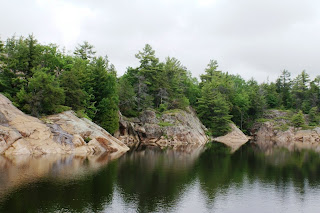
Georgian Bay is a large body of water that has a marked small boat passage running along the NE shore. Parts of it are exposed to the open water of the entire bay but much of it runs behind islands. Parts of the passage are very tight and buoys must be followed carefully. Water depths go from 20 – 50 feet down to only inches in a matter of a boat length.
Georgian Bay is a large body of water that has a
 marked small boat passage running along the NE shore. Parts of it are exposed to the open water of the entire bay but much of it runs behind islands. Parts of the passage are very tight and buoys must be followed carefully. Water depths go from 20 – 50 feet down to only inches in a matter of a boat length.


It started to rain this morning before dawn. When we got up there was still a light drizzle and the visibility was marginal. We tried to relax and just wait; the good news was the winds were less
 than ten. It was quiet around the Sportsman Inn. It is an old in with new management that is totally rebuilding and enlarging the Inn. They hope to be open in two more weeks but there i
 s a lot of work to do. They have a brand new fuel dock and are rebuilding the other docks. They have slips on both sides of the channel and in the busy season they run a pontoon back and forth to the other side.
Final about 9:30 the drizzle had ended and the sky was lighter so we decided to get underway. We had a short run of three miles of open water to get to Collins Inlet. This is a natural

 deepwater channel behind Phillip Edward Island. It is twelve miles long. It is relatively straight and narrow, with lots of wilderness scenery. Shortly after entering Collins Inlet
 we saw a group of about a dozen canoes and nearby two kayaks. I will let the picture tell more.
After Collins there is an open passage of about ten miles before heading back in at the entrance to the Bad River. We then wound around through the Northeast Passage which has a lot of flat
 granite rocks; here is where navigation depends on counting the buoys as you pass them and following the chart exactly.
About 5:30 we had completed 57 miles for the day and we pulled in behind Golden Sword Island. The small boat passage goes by one side of it and there is good water on the other. We got the
 anchor down and Diana got a couple last pictures of our home for the night. The bottle in the picture is on an anchor trip line. I tie a line to the front of the anchor, should it foul and not want to come up the trip line can be used to try and free it.
We had hamburgers on the grill, listened to the loons calling, and watch a lovely sunset. Note the change in the pictures from overcast this morning to clear sky in the last ones. After a slow start it was a near perfect day.

1 comment:
THANK YOU for the beautiful pictures & the heads-up on some of the Canadian part of the Loop. The water looks so blue & clean there! I can see why my dad raved about growing up in Port Severn, ONT on the water. Here's wishing you better luck in the mechanical dept. Do you still love your new thrusters? -Maryann of 4 McGees-
Post a Comment